Maui – Day 3

Another morning consumed by conference.  As for the afternoon, we planned ahead of time and brought our hiking boots with us to checkout the Iao Valley State Park.

Lunch was at Tin Roof.  We had planned to hit this joint after landing in Maui 2 days ago, but they close on Sundays.  I had high hopes for this place because Joe read good reviews, but it was just good, not fantastic.

21
Joe had the mochiko chicken again (bottom left) and I had the saimin ramen with a 6-minute egg (bottom right)

Iao Valley Park is located in the Waikulu area close to the downtown area so it was a short drive to the park.  We quickly learned that we could avoid the park fee by parking alongside the road outside the park entrance.

One thing you’ll notice on the island is that wild chickens are everywhere – at gas stations, grocery store parking lots, and of course in state park parking lots.

24

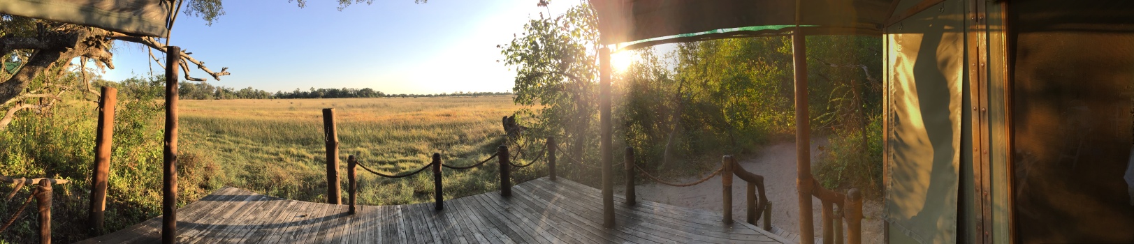
A view from the parking lot…

25

We thought we needed hiking boots, but this was completely doable in flip flops as the trail was mostly paved.  You can climb a flight of steps to get a closer look of the Iao needle.

26

Then there’s another trail bringing you closer to the creek.

27

Both trails were very short and we were disappointed that that was it.  However, we quickly realized that there were trails leading away from the designated trail and decided to check them out.

28

Found a rope tied near a pool of water, and it was very tempting to jump in, but I didn’t have my swim suit with me, so I opted for the next best thing – posing with the rope pretending to swing into the pool.

28 (2)
Odd outfit I know.

We started to encounter denser brush, and I was getting a little concerned that we may get lost and end up needing to be rescued like those missing hikers I had read about a few months ago.  When we came upon a couple who were heading towards us, I asked if there was anything to see further up, and was told that there were no waterfalls up ahead and it was just the same dense trail.  So we turned around.

Checked out the rest of the paved trail and managed to position myself (by going past a warning signage) to get a nice shot of the Iao Needle with Joe standing on the bridge.

30

Since this park visit was literally a walk in the park we had ample time to kill.  We decided to head back to the hotel and do beach stuff.  Unfortunately, the waves were just too strong that we couldn’t really do much.

The beach was pretty much deserted.

31

We did try our best to stay for sunset, but the sandblasts won.

32

When in Hawaii, one must have Hawaiian ice, even though it’s just sugary syrup on ice.

23

Dinner was at Miso Phat again…

22
TNT in the center, and Miso Phat rolls on the sides.

Maui – Day 2

With conference taking up the entire morning, we only had the afternoon to check out the island.

Lunch was at Aloha Mixed Plate in Lahaina.  I had the shoyu chicken which tasted very similar to something I’ve grown up eating.  Joe had the Mochiko chicken, which he wasn’t too impressed with.  The view however, was great.

16
Shoyu chicken (top right) and Mochiko chicken (bottom right), with great view of Lanai island.

I was debating between going for a hike at the Iao Valley park or checking out Wailea/Makena, but since I didn’t have the proper footwear (again), we opted for the Wailea area last minute.

Here’s one of my favorite stretches on Honoapiilani highway.  Love the tree canopy!

20

There wasn’t much in Wailea except for some real high end luxury resorts and the Makena public beach at the end of the road.

17

18

Since lunch was huge, we opted to skip dinner, but we did stop for pie at Leoda’s.  We wanted to get the guava chiffon pie, but that was sold out – we tried again the next day without success, but did finally get it the morning we flew out (we sat outside curbside before going through TSA, enjoying the pies while appreciating the Maui mountain views).

19
Clockwise from top left: chocolate macadamia, pineapple, lilikoi (passion fruit), guava chiffon.

Pies were good – a bit too sweet for our palate, but this is the place to go if you love mousse pies.

Maui – Day 1

Our first time in Maui was in 2016 with mom and dad.  Due to the fact that they were with us, and dad had some medical issues at the time we really didn’t get to explore the island as much as we wanted to.  This time around I made sure we hit everything we wanted to see, specifically to hike the Pipiwai trail to see the bamboo forest.  We also finally got a chance to go whale watching for the first time.

As soon as we landed we decided to get some authentic Hawaiian food.  We ended up at Poi by the Pound that was within walking distance from our car rental company SIXT.  We actually didn’t realize it was within walking distance, and ended up driving around the block.

Joe and I shared the Hawaiian plate which consisted of kalua pork, lau lau, poi, chicken long rice, ahi poke, and salmon lomi.  This gave us a chance to taste all the various local dishes.  My favorite was the kalua pork, but due to it’s saltiness I ended up mixing it with poi, which by itself is rather bland.  However, the combo was actually pretty tasty.

54469CD3-B870-41E1-967F-2700CF855A95
Clockwise from top right: salmon lomi, Lau Lau, kalua pork, rice, salad, chicken long rice, poi, ahi poke.

After lunch we were on our way to our hotel – the Kaanapali Beach Hotel (the same one we stayed at 4 years ago).  I decided to stay at KBH due to it’s proximity to the Sheraton where the conference was being held.  The other reason why I picked KBH was that they do not charge a resort fee like all the other hotels.  Personally, I don’t like paying for resort fees as they really don’t add much value to my stay – I don’t need wifi and free local calls, as that’s was a personal cell phone is for.

Instead of driving clockwise from Kahului to Kaanapali like we did last time, we opted to drive counterclockwise to check out the part of the island we didn’t get to see last time.  The clockwise route is a major thoroughfare between Kahului and Lahaina, whereas the counterclockwise route is a one-way winding route that is slower, but much more scenic.

1

The cloud cover lifted as we continued on.

2

The one thing I love about Hawaii is how lush and green everything is, especially the windward side of the island.

3

The contrast of the green mountain and blue ocean.

4

5

Imagine living in a place like this.  Terribly inconvenient, but you’re in your own paradise.

6

One thing we’ve learned over the years, is that if you see a bunch of cars parked on the side of the road – stop, and check it out.  This is what we were awarded with after a 2-minute trek on the trail.

7

Getting closer to the ledge, at risk of getting blown over.

9

It was really windy the week we were there as you can see from the waves being picked up by the wind.

10

A closer look.

11

Interestingly, there are no signs along the road pointing out scenic vistas.  One of them being the Nakalele blowhole I’ve wanted to check out last time.  The only reason why we ended up at the blowhole this time was all thanks to the telltale sign of a huge gathering of rental cars.  We didn’t even know what we were stopping for until we saw this sign on the trail.

12

One other thing we’ve learned over time is to always heed warning signs.  So we steered way clear away from the blowhole – maybe we stayed a little too far.  The other reason for not hiking all the way down was due to the fact that I was wearing flip flop sandals, which was not the most appropriate footwear for the situation.

IMG_5134

With all the stops along a narrow winding road, we finally reached the hotel some time after 4PM.  As soon as we dropped off our bags, we headed over to the Whalers Village to pick up one of my favorites – Honolulu Cookies, to bring back to the office after the trip.

Caught a rainbow on our way back to the hotel room.

14

For dinner, we opted for sushi since we hadn’t had sushi in years despite the fact that we live in California.  We opted for Miso Phat given that they get their fish same day off their own boat “Shiso Phat”, and let me tell you the fish is absolutely fresh and delicious, especially their hamachi.  I can’t remember the last time I had such good sushi other than back in 2009 at the Tsukiji Fish Market in Tokyo.  In fact, it was so good that we ended up having dinner there 3 nights out of the 5 – we would’ve gone 4 had it not been for our 13-hour Hana highway trip that drained us by the time we got back to the hotel in the evening, and we opted to skip dinner all together.

If you ever end up at Miso Phat, make sure to order the Miso Phat roll, TNT roll, and spicy hamachi roll.  Also the joint doesn’t have a liquor license, so BYOB (there’s a deli next door that sells good Japanese beer and sake).

15


Mount San Jacinto

Lately I’ve felt the need to take a break every 3-4 weeks.  Working daily is mentally draining.  Call it burn out or compassion fatigue, either way I need a recharge.  I realized that I don’t necessarily need a long getaway to recharge, I simply need a day in nature to allow the weight to fall off my shoulders.  After the exhilaration and serotonin jolt I got from the Mt. Baldy hike, I quickly started to plan another hiking trip.

It’s amazing how little I’ve seen of SoCal after having been living here for the last 8 years.  Our lives have basically been confined to the 25 mile radius of our home.  On weekends we opt not to venture far from our home because we simply love staying in and near the area we live in.  Plus, the SoCal traffic is a huge deterrent to drive anywhere.  With that said, this year I’ve decided to take off a Friday every 3-4 weeks to explore SoCal.

To find another hiking trail, I consulted HikingGuy.com.  He has detail information and turn-by-turns on his website.  It’s a wonderful resource.  I wanted something challenging in an alpine environment.  In order to find that in SoCal, one must go up in elevation.  Meaning at least 8000 ft above sea level.  The best part about hiking in such high elevation in the summer is the temperature.  It could be 100F in the desert floor, but a cool 50-60F up top.

One interesting trail is the PS Tramway to Mount San Jacinto peak located in the San Bernardino Mountains in Palm Springs, which is about a 2-hour drive from Laguna Beach.

You take the Palm Springs Tramway up 6000ft from 2000ft.  The cost of the ride is $25, which is a pretty good deal if it can shave off 6000ft of ascent.

IMG_3641

The whole trip took 10 minutes, and the best part about the tram is that the floor rotates allowing you 360 degree view while you stand still in the tram.

IMG_3642

A view down toward the desert floor.

IMG_3646 (1)

Once you get off the tram, you’re at 8000+ft and in alpine territory.

IMG_3650

IMG_3651

IMG_3654

Our goal was to reach the summit at 10,834 ft, which meant we still had a good 2600 ft ascent and 5.5 miles ahead of us.  Our first goal was to reach Wellman’s Divide at 9100ft.

IMG_3701

A view from Wellman’s Divide…

IMG_3665

After a quick water and snack break, we headed for the summit 2 miles away.

Found a nice cutout in a tree for a photo-op…

IMG_3671

Scenes along the way…

IMG_3678

You can see the desert floor to the left.

IMG_3683

There is still snow left at this elevation in June.

IMG_3684

IMG_3685

Near the summit, there’s a shelter with 2 bunk beds that you can stay at in case you’re caught in inclement weather.

IMG_3699

Judging by the sign, we took the easy way up.  Some people actually hike from the desert floor in Idyllwild.

IMG_3700

Luckily we brought hiking poles this time, because there was a patch of snow up the final push that made trekking tricky.

Finally made it up to the top after getting overtaken by a bunch of boy scouts…Ah youth…

IMG_3688

I read that on a clear day you can see Catalina Island off the coast of California to the west and Mt. Charleston in Nevada to the east.  Unfortunately, there was quite a bit of haze while we were up top, and chose to face east for our lunch break.

IMG_3693

After the half hour lunch break, we starting our hike back down…

IMG_3694

There was no way to hike down this without the use of hiking poles.

IMG_3695

The hike took us a total of 7.5 hours (plus the 1/2 hour break up at the summit).  It took 4 hours to go up and 3 hours down.  By the time we got back down to the desert floor, we were ready for some real food after a whole day of trail mixes.

When it comes to eating, it’s always Joe’s responsibility to find yummy food because it’s important to him.  After much researching prior to the hike, we decided on Workshop Palm Springs.

The restaurant has a very hip, minimalist, industrial feel.

IMG-3710

The Palm Springer cocktail was yummy!

IMG-3711

The octopus carpaccio was especially refreshing after a long day of hiking…

IMG-3713 (1)

and the mussels were to die for.  The broth was so good that we quickly accepted another round of buttered toasted bread in order to sop up the broth.  It would have been easier had they just offered us a straw each.

IMG-3714

I opted for the saffron risotto because I needed the carb for my scheduled 10 mile run the following day.

IMG-3715

Joe had the pork chop with amazing relish.

IMG-3716

Finally, the pistachio mouse with passion fruit gelatin, which unfortunately overpowered the pistachio.

IMG-3717

This hike was unique because of the tram, but not quite as interesting as Mount Baldy.  For now, we’re going to take a break from hiking as I think we got the hiking bug out of the system.  Luckily, we have a more sedate Vegas trip coming up in 3 weeks…

Mount Baldy

Hiking Mount Baldy was a last minute decision.  While at work on Friday, I was itching to go somewhere and do something over the Memorial Day Weekend.  Hiking is always fun, so I googled hiking trails in SoCal.  I didn’t want just any two-bit hiking trail like the ones we have in Laguna Beach.  I wanted something challenging, fun, and beautiful, which meant I had to look at higher elevation climbs.  Mount Baldy, AKA Mount San Antonio, fit the bill.

Mount Baldy is located in the Angeles National Forest, which is an hour and change north east of us.  Mount Baldy summit is the highest peak in LA county, topping out at 10,064ft.

After stopping off at the visitor center to pay for our $5 Adventure Pass we headed to Mankers Flat, the start of the trailhead.

There are 2 ways of getting up to the summit.  The Devil’s Backbone or the Baldy Bowl trail.  From Mankers Flat, we picked hiking up the paved road to Mount Baldy Resort, then hiking up the Devil’s Backbone Trail to the Summit.

IMG-3553

One thing that caught us off guard was the snow.  It had rained the night before, and any precipitation above 8K ft translates to snow.  I think had we known there was going to be snow, we would have scrapped the hike because we were warned not to hike the trail when there is snow.

However, snow makes this place look like a wonderland.  It’s beautiful beyond description.

IMG-3559

Some people opted to take the ski lift up to the resort before picking up the trail.

IMG-3561

A view above the clouds before the Devil’s Backbone Trail.

IMG-3564

Looking east towards the Mojave desert.

IMG-3572

The start of the Devil’s Backbone trail.  Called the Devil’s Backbone trail because you have sheer drops on either side of the path.  When icy, this is where people fall off to their deaths.

IMG-3575

Looking back at the hikers crossing the first section of the backbone.

IMG-3577

Hiking up towards the second section.

IMG-3578 (1)

Never would I imagine this kind of view existed in Southern California.

IMG-3579

Posing on the second section of the backbone.

IMG-3584

Certain sections are narrower than others.

IMG-3587

Immediately past the backbone, there was a narrow part that hugged the cliff wall.  Some of the snow had turned slushy and slippery, and at one point I thought I was going to fall off.  I think I would have been perfectly fine had there not been any snow on the ground.  This is when a set of hiking poles, and some crampons would come in handy.  I just remember digging my nails into the side of the wall to keep me from falling.

I had never been so scared in my life.  Even Joe said he’s never seen me so frightened.

At the bottom of the last summit.  This part was hard only for the fact that it was freezing and the wind was whipping at top speeds, and we had no where to hide.  This section was completely exposed.  Joe couldn’t feel his lips.  I just felt stinging on the right side of my face as the wind was coming from that direction.

IMG-3592

As we were hiking, we both had the same thought about turning around (a group had turned around).  However, for me, the thought of having to go back to the narrow path where I thought I had almost fallen off made me push forward.

We finally made it.  Four and a half hours and 4000 ft from the parking lot, we made it to the summit.  The last section took us a good 40 minutes to hike up.

IMG-3598

Thanks to the gale force wind, we chose not to linger at the top, and we made our way down the Baldy Bowl trail.

IMG-3604

Breathtaking!

IMG-3605

Can’t remember the last time we saw snow.  This was an impromptu thing Joe did.  He just plopped down to make a snow angel.

IMG-3607

Luckily, the Baldy bowl trail was protected from the wind, and we decided to have our mid-day snack here while enjoying the view.

IMG-3608

View along the trail at lower elevation.

IMG-3609

Finally, at the end of the Baldy Bowl trail which connects to the paved road we had hiked up 7 hours ago.

IMG-3612

I am so glad we did this impromptu hike.  Granted I almost died of a panic attack, but it was worth it.  Would I do it again?  Absolutely, but only after the snow has melted, and after investing in some good hiking poles.

Las Vegas

We had originally planned to hike the Water Tank Trail in Escalante after the St. George Marathon, but the forecast was calling for rain in the region so we scrapped that plan for fear of getting caught in a flash flood in the canyon.  We opted to go to Vegas last minute to feed the tummies – my legs thanked that decision.

Nowadays Vegas is less about gambling, and more about food and entertainment.  The day we arrived in Vegas was also the day of the big Conor-Khabib fight at the T-Mobile arena.  Rooms were going for at least $400 a night on the strip.  The cheapest was the Trump Hotel, but I would never give my money to anything with the Trump name.  So we ended up at the Westin @ Lake Las Vegas in Henderson for a night (we had already booked a room @ Delano for the next day).

Entrance to the Westin.

IMG-2489

The stay was pretty unremarkable, and there really wasn’t much to do there other than lounge by the pool.  But it was a great way to catch up on some sleep and rest.  We did have the pre-requisite post-race steak dinner @ Sonoma Cellar Steakhouse.

We checked out early in the morning so we could get to the Strip, check in, and start exploring.

I used my points from Chase Sapphire to book a suite (all rooms in Delano are suites) @ Delano.  I personally like staying at non casino properties as they tend to be more quiet, and if I ever return to Vegas in the future, I would definitely stay at Delano again.

Vegas is all about show.  Everything is bigger, splashier, and more ostentatious.  The only place that can beat Vegas in this department is probably Dubai, and I’ll let you know for sure after we return from our Dubai/Africa trip next month.

Lunch was @ Milos located in the Cosmopolitan.  If you like clean Greek/Mediterranean seafood, this is the place to go.  Their grilled octopus was to die for.  Their salmon tartare was just as heavenly – even Joe who doesn’t eat salmon (due to the fishiness) liked it.

Went to an escape room after lunch – we didn’t even survive the easiest room.  Sometimes when you’re life isn’t on the line, there’s no true urgency.

Dinner reservation was @ Bardot, a French bistro in Aria.  The duck with the raspberry sauce was amazing!

Surely, we didn’t have any room left for dessert, but we made room and shared a mille feuille from Aria Patisserie before heading off to the David Copperfield show.

On our way back to CA, we stopped by the art installation by Ugo Rondinone.  It’s unclear how much longer they’ll keep the Seven Magic Mountains at its location but it will at least remain there by the end of this year.

IMG-2527

Sticks out like a sore thumb in the drab desert.

Now thinking back, going to Vegas after the marathon was definitely a better choice than going hiking.  We got to gorge before returning to our austere living of chicken breasts with celery & carrots.

St. George Marathon

Entry into the St. George marathon used to be on a lottery system, which always turned me off because I hate the unknown.  However, in 2017 they scrapped the lottery system due to the decrease in demand thanks to a crop of new downhill races like Revel siphoning the runners.  So this year, I decided I’d run the St. George marathon.  The goal was to qualify for NYC.  NYC is another lottery race, but there is a guaranteed entry if runners can meet the qualifying standard.  For a woman my age, I’d have to run faster than 3:38, which I missed at this year’s Boston by a minute and 18 seconds (interestingly, qualifying for NYC is harder than qualifying for Boston).

I felt that my chances of qualifying for NYC were pretty good at St. George given the monster drop in elevation (2000+ft)  from start to finish.  The problem with downhill race is that if not trained properly, the race eats up your quads and you’ll end up finishing slower that you had planned.  So for this race, I was OK missing a lot of my tempo stamina runs, but I made sure I did a lot of lower body strengthening exercises focusing on my quads and gluts – squats, lunges, dead lifts, bridges, you name it, I did it all.  My peak weekly training miles never exceeded 35 miles a week, as opposed to a normal training cycle, that peak mileage would have been closer to 50 miles a week.  As race day approached, I started to worry that I wasn’t running enough and started to have doubts about being able to qualify for NYC, so I begrudgingly adjusted my goal to just qualifying for Boston 2020.

The race was on a Saturday, which meant we had to take Friday off to drive over to Utah for packet pickup.  We left early in the morning because we wanted to hit Vegas for lunch.  Stopped by Block 16 at Cosmopolitan for some donuts @ the District and some fried chicken @ Hatti B’s for Joe.

Walked around Aria and the Crystal shopping center to burn off some of the food we just had before getting back on the road.

St. George is about an hour and 45 minute drive from Vegas.  By the time we got to the Dixie convention center for packet pick up it was almost 5PM, which was perfect for dinner (for me).  To make things easier, I decided to have their pasta dinner at the convention center since I didn’t want to run around town looking for pasta.

Runners at the pasta dinner…

IMG-2467

After scoffing down 2 full plates of pasta with bolognese sauce we were off to check-in.  The plan was to go to bed ASAP, but I had to get in a shake out run to loosen up the muscles.  Luckily, no one was on the lone treadmill at the facility, and I was able to get the 30-minute run out of the way.  Unfortunately, the room we stayed in was too loud (street noise and AC noise), I ended up getting only 3 hours of sleep before getting up at 3AM to get ready.

Having run a few races, I’m pretty good at figuring out how to prepare for the pre-race wait.  Knowing that it was going to be cold and possibly rainy at the start, I brought my Boston heat poncho with me, and it worked like a charm.  Found a spot with good wind protection and waited until the race was about to begin.

St. George had pacers for 3:35 and 3:45, and nothing in between.  The last time I ran with a pacer was back in 2013 at CIM since Boston doesn’t have pacers and the only races I’ve done since CIM were all at Boston.  My goal was to run a sub 3:40 so I positioned myself between the 2 pacers.

My plan was to run conservatively the first half so that I wouldn’t blow up in the second half.  It was kind of hard to gauge my pace in the beginning as some people were taking off like rockets, and others were running at a much slower pace.  Unlike at Boston, everyone around you is running the same pace as you would be.  The 3:45 pacer started catching up to me and I knew my pace was too slow.  I decided to run with him for a mile so that I could settle into a rhythm, and then I asked how he was planning to run the race.  When he told me he was running even pace throughout, I knew I had to take off.

My first 2 miles were in the 8:44, 8:36 range.  For the next 5 miles, I averaged a 8:08 pace, and it felt effortless thanks to the downhills, and this was when I thought, maybe I could go for a 3:35.  Then the big Veyo hill came, and my pace dropped to a 9:10.  Miles 8-12 were slower miles (8:45) thanks to the tiny uphills.  I knew once I was past this point it was all downhill.  Miles 13-18 averaged 8:00, then something happened at mile 19 when my pace dropped to a 8:44.  I think it was the headwind and slight incline that I wasn’t expecting.  This was about when I was attempting to draft off people, and when the shin splints and calf cramps started.  Both these cramps could stop me dead in my tracks, and I decided to change my running gait to ease the pain.  I started lengthening my strides, and that worked, which would explain the 7:51, 7:25, 8:04, 7:58, 7:59 pace for the next 5 miles.  I took advantage of the icy hot aid stations (they have volunteers rubbing icy hot all over where your cramps are).  I was amazed that it had actually helped – LOVED IT.

At mile 25 I caught up to a girl who had been running and chatting with me at around mile 6.  She was walking and I asked if she was OK.  She said exasperatingly, “I just want this to end”.  I decided that I’d run with her to get her going again through encouragement and mental games.  Obviously this was one of my slowest miles (8:53), but it was also my most memorable mile.  However, I had to take off when I saw the clock on the road, and had erroneously thought that I was about to miss my 3:40 goal.  I hadn’t realized that the time on the clock reflected the time that had elapsed since the start of the race, and I didn’t cross the start line until a minute and 38 seconds after the race had started.  When I had .2 miles left, I saw that I was on pace to possibly finish under 3:38, and it was a race against time to the finish.

Final time – 3:37:44.  I qualified for NYC!

IMG-2473

Sedona – Path Less Traveled

I had wanted to hike Soldier’s Pass, but we were 30 minutes late arriving to the tiny parking lot, which meant no parking for us.  So we headed over to the Fay Canyon trail head, which is billed as a easy hike but with a spectacular vista at “the end”.

The hike was truly a walk in the park, with a flat terrain and rock walls to the sides.

This rock wall looks like a choo-choo train…

IMG_2307

The trail was flat up until the end of the maintained trail.  Then you’re looking at hiking up this…

IMG_2308

Must scale this to see the view…

IMG_2312

Most people stopped right here, but we kept going only because we wanted to see what was beyond.  After a certain point the trail grew thinner and fainter.  At one point, the trail was no longer obvious, but we saw cairns and started following those.  We ended up against a cliff wall, and this is the view everyone else missed…

IMG_2318

Resting and enjoying the view…

IMG_2319

Where’s Waldo?  This shows you the sheer size of the place.  There were darker marks along the rock walls indicating water falls.  I can only imagine how pretty this place would be when there’s water flowing.

IMG_2324

Again, where’s Waldo?  The best part was that we had the whole place to ourselves.

IMG_2330

This was a hike that was billed to be an easy hike, and was supposed to only last 55 minutes, but ended up taking us 4 hours to complete.  I’m so glad we kept pushing on because it felt more like an adventure than just any old hike.

Back to the spot where everyone else had turned around…

IMG_2331

After 4 hours, we were both hungry and a cold beer sounded like the perfect remedy.  The plan was to hit another hiking trail, but after 2 beers each we were done.

We did manage to check out the Tlaquepaque Arts & Crafts Village before our dinner reservation at Mariposa.  Joe really liked a piece by Robert Charon he saw at the Renee Taylor Gallery, and I’m thinking it might be a good 45th birthday present come September.

Casa Sedona Inn

Casa Sedona Inn is a boutique hotel with 16 rooms.  We were lucky to snag the last room available for Memorial Day weekend.

We ended up with the Sierra Vista room.

Bathroom with a jacuzzi tub, which we never got a chance to use.

The room had it’s own patio entry.

DSC_1292

Dining, patio, and ‘lobby’.

They serve breakfast (except Mondays and Tuesdays) with some interesting items such as truffle brie scramble eggs, savory ham and cheese waffles.

After we checked in, I took a 2-hour nap before venturing out again.

There’s an iconic image of Cathedral Rock I (along with everyone else) wanted to capture, and the place to be is the Crescent Moon picnic area located within Red Rock Crossing.

We got there about an hour and a half before sunset.

DSC_1305

DSC_1315

As did everyone else including a wedding party…

IMG_2302

IMG_2303

Since we had dinner reservations at Dahl & DiLuca, we didn’t get to stick around for the Cathedral Rock to turn orange.  Dinner was yummy though…

Sedona

Sedona is one place that keeps drawing us back, and there’s always something new to explore each time we’re there.  Our first trip to Sedona was in 2006 when we had just moved to Tucson, and were in awe of the red rocks as we were driving into town.

102_0239

Our second time there was in 2008 when we stumbled upon the West Fork hiking trail.

102_0230.JPG

Since moving to CA in 2010, we’ve been busy exploring places locally, and hadn’t been back to AZ in 8 years.  Joe wanted to bring the car on a road trip, and living in coastal CA one only has a few options – go north toward Napa, south to Mexico, or inland.  Mexico’s out given how dangerous Tijuana is, and Napa we’ve been not too long ago, so we opted inland.  Palm Springs, which is 2 hours away, didn’t sound exciting enough.  Neither did Phoenix and Tucson.  Personally, I think the most beautiful area in all of United States is in the southwest – southern Utah and northern Arizona.  Since we’ll be heading to Vegas and southern Utah in October, we thought, “why not Sedona?”

We cobbled together a last minute trip for Memorial Day weekend.  Snagged the last room at Casa Sedona Inn, and we were off to do some hiking.  FYI, avoid Sedona Memorial Day weekend – too busy and crowded, good luck trying to find a parking spot at the trail head if you arrive 30 minutes after gate opens.

We left home a little after 11PM Friday, and drove 7.5 hours to Sedona – best thing about driving at night, no traffic.  We got to the Mescal trail head parking lot @ 6:45AM – early enough to still get a parking spot, and we were off towards Devils Bridge.  For those with high clearance vehicles, they can drive right to the Devils Bridge trail head.  For the rest of us we had to either park at the Mescal trail head or the Vultee Arch entrance, and then hike towards the Devils Bridge trail head.  Of the 2 options, I recommend parking at the Mescal trail head, as the hike in is shorter.

IMG_2221

IMG_2226

Devils Bridge…

IMG_2232

We were fortunate enough that there wasn’t a huge crowd by the time we got to Devils bridge – if you want to hike this and avoid the crowd, start early.

We witnessed 2 proposals on the bridge.

Us, old married folks, on the bridge…

IMG_2236

Before reaching Devils Bridge there’s a path that splits off to give you a view of the underside of the bridge, which I think it’s totally worth checking out.  A lot of people bypassed this…

IMG_2260

By the time we got back to the car, it was only 10:30AM, so we were off to the next hiking trail since check-in wasn’t until 3PM.

Cathedral Rock.

We had more fun with this one because it was scrambling up the rock.  But first, we needed to find parking, which the lot was full.  It took some driving around – going to the overflow parking lot, Yavapai Vista, which was not ideal; looping back to the Cathedral Rock parking lot, and tracking hikers who were heading back to their cars.

Beginning of the trail…

IMG_2266

Going up…

IMG_2288

IMG_2287

IMG_2273

Photo op along the ledge…

IMG_2277

The vista from the top…

IMG_2284

IMG_2281

IMG_2282

By the time we were done I was ready to crash since I had gotten 1 hour of sleep in the last 30 hours.

Time to check in…but not before checking out Chapel of the Holy Cross…

IMG_2291